Expert Commercial Aerial Imaging NT, Services in Darwin
Discover unparalleled commercial aerial imaging services in Darwin, providing high-quality visuals for diverse projects. My expertise and training combines cutting-edge drone technology with a keen eye for detail to deliver stunning results for your marketing, real estate, or event needs. Trust me to capture your vision with precision, ensuring impactful imagery every time.
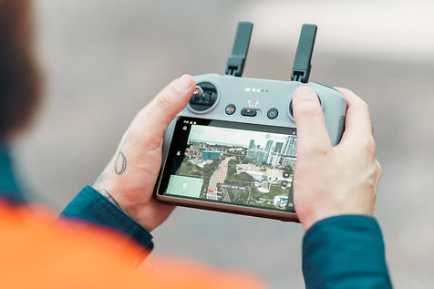
My commercial drone and aerial services are commonly used for aerial photography in Darwin across marketing, real estate, construction, events, tourism, documentation and research projects. From short aerial captures to larger commercial productions, each project is scoped based on location, airspace requirements and final deliverables. Pricing is typically structured as hourly, day-rate or project-based, depending on the scope and complexity of the work.
How It Works
Step 01
Initial Brief & Compliance Planning
Once you share your project details and contact info, I’ll arrange a consultation to understand your goals: usage, location(s), timing and footage needs.
Because drone work in Darwin often involves controlled military airspace and restricted zones, I’ll begin preliminary location scouting and airspace checks at this stage. I’ll also confirm that all safety assessments and flight planning align with my Remote Operator’s Certificate (ReOC) and CASA regulations.
You’ll then receive a detailed quote, scope of work, and an outline of any specific approvals required.
Step 02
Location Scouting & Flight Planning
Before the shoot, I’ll complete the required airspace clearance checks and, if needed, coordinate with relevant authorities or land managers. During the wet season, this will also include weather condition checks.
I’ll share this plan with you so you know exactly where we’ll fly and why, giving transparency and confidence in both safety and deliverables.
Step 03
Drone Capture &
On-Site Execution
On the scheduled day, I’ll arrive with all necessary equipment and required risk assessments in place.
I’ll set up the site with appropriate safety briefings and ensure compliance with CASA’s guidelines and your project’s requirements.
While in the air, I’ll capture the agreed shots. Maintaining clear communication so you always know what’s being filmed and when. My focus is efficient, safe flying with creative results that meet your brief.
Step 04
Post-production & Delivery
After the flight, I’ll process and refine your drone footage and imagery. This includes stabilisation, colour grading, and optimising output formats in line with your requirements.
You’ll receive a private online delivery, with high-resolution downloads and clear instructions on usage. If you require licensing details or extended rights, I can include them here too.
Plan Your Ariel Project With Confidence

All drone operations are conducted under a valid Remote Operator Certificate (ReOC) and in line with CASA guidelines.
To prioritise safety, I hold:
-
a Remote Operator Certificate (ReOC) valid for drones up to 25 kilograms.
-
an Aeronautical Radio Operator Certificate, allowing operations within restricted and controlled airspace - including within 5.5km of Darwin Airport.
-
appropriate drone operator insurance and public liability up to $20 million.
-
approval under Regulation 16A(3) of the Air Navigation (Aircraft Noise) Regulations 2018.
-
approval to operate drones during night flights.
-
all signage and safety gear to mark drone operational areas.
I undertake detailed location and airspace assessments prior to every flight and complete a Job Safety Assessment for each location.
In unique or complex scenarios, operations outside standard conditions may be possible, however these are assessed and discussed on a case-by-case basis to ensure full compliance and safety.


